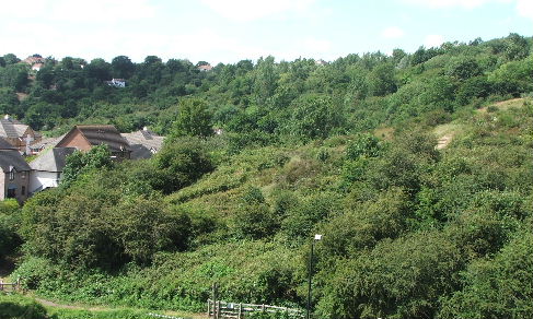
Adjacent to Troopers Hill LNR is an area of council owned woodland. This area is known as Troopers Hill Woods or Crews Hole Woodland and covers 4.79 Ha (11.8 acres).
The woods are bounded by Troopers Hill LNR to the east; Crews Hole Rd to the south; Lamb Hill to the west and Malvern Rd and Troopers Hill Field to the north.
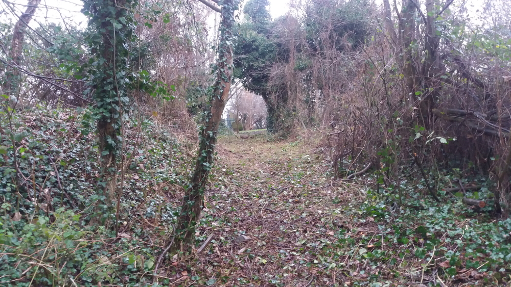
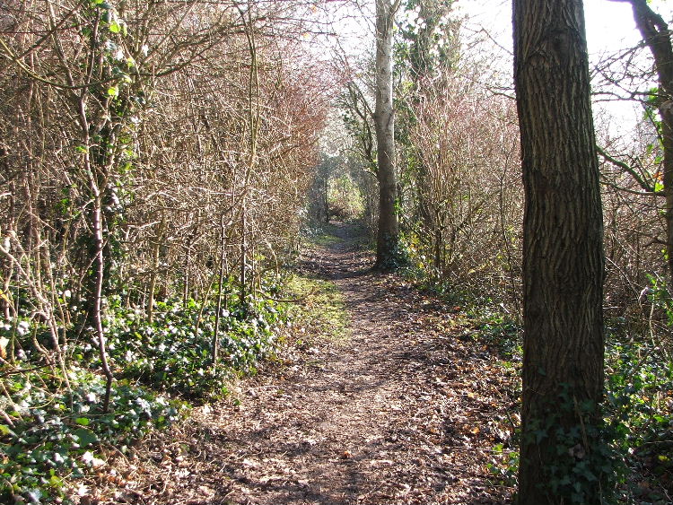 Several paths lead through Troopers Hill Woods - you can explore them by following the Woodland Trail or the waymarked routes from the Hill and the Field to Crews Hole Road.
Lots of wildlife lives in the woodland, including deer, foxes and owls and you may be lucky enough to see some of them.
This area was used to tip builders rubble in the past, so there may be hazards if you leave the main paths.
Dogs are welcome on or off lead, but please keep dogs under control so as not to disturb the wildlife, especially in the Spring when there may be young around.

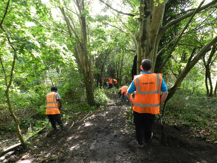
Layby Works, Crews Hole Road - Spring 2025
The Woodland Path & Steps through the Woods meet Crews Hole Road next to the new housing on the site of what used to be the Lamb Inn.
 The rough car parking area here was a hotspot for flytipping. To address this, in 2019, the Area Committee of Local Councillors allocated funds for this parking area to be improved with a proper footway and fencing.
Construction of a layby with a footway and fence alongside to replace the rough parking area was completed in April 2025. A new gate and some cycle racks have been installed at the western end of the layby at the entrance to the path into the Woods.
The aim of the work is to give the area the appearance of somewhere that is managed; rather than that of an abandoned area of waste ground. This should reduce the amount of flytipping. It has also made the footway safer for pedestrians and improved the appearance of the area generally.
A separate project to improve the crossing of Crews Hole Road, where the footway changes side at the eastern end of the layby, was completed in June 2025 - this makes it safer to get from the woodland path to the riverside path.
 The Birch Collective - Recoupe - from Spring 2025
"Weekly woodland regenerative sessions using traditional skills in Troopers Hill Woods"
Run by The Birch Collective, Recoupe is a regenerative ecological project breathing new life into Troopers Hill Woods.
Their goal is to build a healthy ecosystem with abundance at its core, creating a nurturing green space for nature and people to enjoy, explore and thrive.
If you’d like to be part of a group of volunteers who: Help care for the woods, Learn traditional woodland skills, Spend time outdoors with nature, Meet other woody folk...Then Recoupe is for you!
Sessions are run by Luke and Tim, with a group size of up to 12 volunteers.
Find out more and sign up via The Birch Collective website
Sale of Blackswarth Road Wood - September 2023
To the west of Troopers Hill Woods, beyond Strawberry Lane, is 'Blackswarth Road Wood' which is another area of woodland between Avon View Cemetery and the river. Blackswarth Road Wood is privately owned and there is no public access.
Blackswarth Road Wood was put up for sale by auction in the summer of 2023; a crowdfunder to buy it reached its target, but the charity was outbid at the auction.
Woodland Management Winter 2017/18
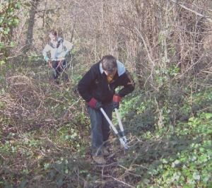
 Also thanks to the funding from the Avon Frome Partnership, works were carried out in Troopers Hill Woods during the winter 2017/18 to further improve access.
The work was based on suggestions made by Friends of Troopers Hill and recommendations from an ecologist.
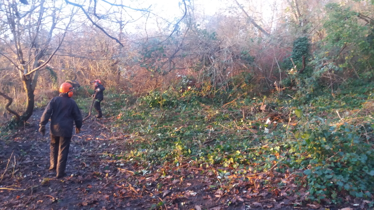
The first stage in December 2017 included the removal of some large buddleia bushes that were blocking the lower path and some selected thinning of trees to enhance the ecology.
 We were also able to open up the overgrown route into the woods from the entrance between the Field and the Hill - 'Top of the Hill'.
This was a track originally constructed when the woods were used as a tip in the 1960s & 70s.
The work was carried out for Bristol City Council by Green Mantle.
Woodland Path & Steps to Crews Hole Road 2015-16
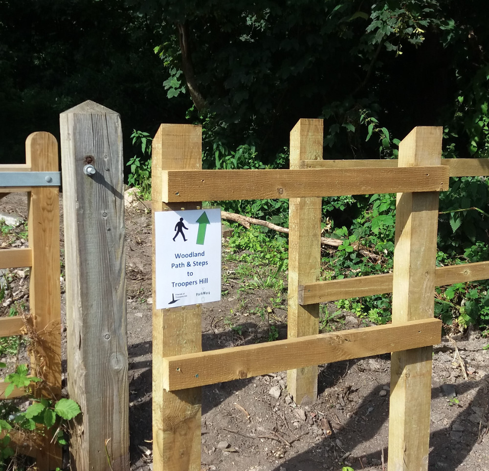 This path gives an alternative shorter route to Crews Hole Road from the Hill than the route via Lamb Hill. Waymarking was added August 2018.
At the bottom, next to the new houses at Old Lamb Close, the entrance is now through a metal gate at the west end of the layby constructed April 2025 on Crews Hole Road. This replaced the original wooden fence chicane shown here.
At the top, walking away from the Hill on the lower woodland path, the new path goes down to the left just after the 'Not Lost' waymarker on the Woodland Trail.
There are a lot of steps on the path and as with all the paths through the woods it is not surfaced, so the path is unfortunately not suitable for the less able.
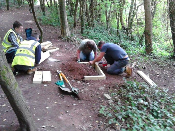
 In early 2015, through Bristol Parks Forum, we heard about an opportunity to use the ParkWork team on Troopers Hill if we could find funding for any materials they would need.
ParkWork offer training and skills development for people who need additional support to secure permanent employment.
We knew that, following the initial clearance of the route as part of our Stepping Forward Project (described below) the steps on the path needed to be built to a higher standard. This semed to be an ideal project for ParkWork.
 At around the same time we heard that Beese's were kindly giving us a further donation this year and with their support we therefore agreed to use the majority of this donation to fund the materials to allow this work to go ahead.
Work on the steps started on 18th August 2015. ParkWork aims to give each group on placement an opportunity to aquire a range of skills and therefore construction of the steps was carried out by a number of groups over the following months.
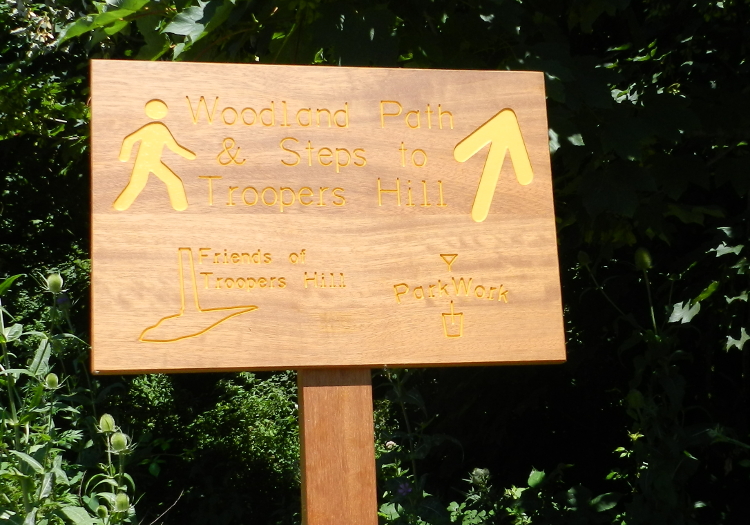 ParkWork then did some further work to create the new entrance to the path near the rough parking area on Crews Hole Road, this was completed in July 2016.
We were pleased that Didac Ltd agreed to provide, free of charge, a wooden sign to mark the entrance from Crews Hole Road which is near to their Woodwise Academy, this was installed in 2017. Then in 2018 we installed some additional waymarking on this path (see above).
New Path 2008/9
 With the help of pupils from John Cabot Academy, who are taking part in the Duke of Edinburgh's Award scheme, we opened up a path through the woods from the 'Gillian's Glade' opposite one of the red benches on Troopers Hill Field down to the lower path. This work started with two enthusiastic pupils in 2008 and was continued in 2009. It was carried out as part of our regular Work Parties and at separate additional sessions. The steps on this path were rebuilt in April 2012 as part of our Stepping Forward Project.
History of Troopers Hill Woods
Cottages & Rough Pasture
In Elizabeth's Emra's time (early 1800s) the much of the area that is now woodland probably had a very similar habitiat to that on Troopers Hill LNR today. There were some cottages and probably some market gardens. Malvern Rd and the adjoining streets were developed in the late 1800s, but the steep sides of the Avon Valley remained undeveloped.
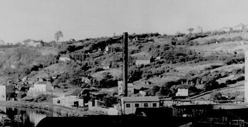
On 21 Dec 1956 the area was purchased by Bristol City Council from the estate of the late EW Smith for use as a 'Tip'. The photo above, taken from the tar works, shows it as it was in 1953. The land was just over 12 acres and was described as 'Allotment and rough pasture land with one cottage in Lamb Hill and the sites of 3 other cottages'. The purchase price was Ł2,120. You can read about the cottages and some of the people who used to live there on our Memories Page.
The area as it was in 1953 can also be seen in this Britain from Above photograph.
"Mudville" - Malvern Road Tip
From around 1965 the site was 'Malvern Road Tip' or 'The Corporation Tip'. We don't believe that any domestic waste was tipped on the site - just building rubble and excavated material - it is reported that the tip took 'earth from Bristol's road works'. The tip extended into the adjacent quarries on Troopers Hill itself.
Several different people had told us that material from the excavation of the underpass at Old Market was tipped there - and this has been confirmed through recent searches in the Newspaper Archives.
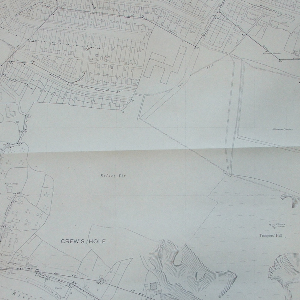 While the access to the tip was originally via Malvern Rd; in early 1967 an access track was installed from the end of Summerhill Terrace across what is now Troopers Hill Field (but was then still allotments) . The track is shown on a 1968 map, see adjacent image. This was to take the increased traffic bringing thousands of tons of excavated earth from the Old Market Underpass scheme. An access track or ramp was also constructed at this time to reach the lower parts of the tip.
Prior to the new access at Summerhill Terrace coming into use, the papers reported that the Malvern Road, Diamond Road and Jubilee Road area was known as "Mudville" due to the state of the roads with many lorries a day bringing material to the tip.
We heard a story that one of the lorries over-turned, rolled down the bank and is now buried. The archived newspapers report a 'lorry crashing 100 feet down a tip' in July 1966 and the driver having a lucky escape. The report claims that 'the lorry will be salvaged tonight' but we don't know if that ever happened.
Another story we have heard was that Crews Hole Rd had to be closed for a while because the tipped material began to slide down the hill. Again this is confirmed by newspaper reports, with the road being closed over a weekend in July 1968 due to 'cracks three feet deep' appearing. The movement of the tip was then monitored, in February 1969 it was reported to have moved 20 feet in 95 days. By September 1969 movement had slowed but still happening and there were plans to spend Ł10,000 to stabilise it.
It is not clear exactly when the tip closed, but in October 1968 'angry residents' were telling the local paper that 'the Corporation had "done nothing" about landscaping the tips and turning them into a play space for children'. This had been promised two years before - at the time when the compaints about 'mudville' were at their height. So while tipping had probably ended by late 1968, it was most likely the early 1970s before the remedial works to stop the tip slipping and the creation of the play area on the Field were complete. We cannot find any report to confirm these later dates - please let us know if you have any information.
Public Woodland
Once the tipping had finished some trees were planted to help stabilise the site and over time other trees and shrubs established themselves. We can now enjoy walks through woodland that has grown up over the last 50 years or so.
 Thanks to funding secured by the Avon Frome Partnership, some additional waymarking was installed in the Woods in August 2018 as part of our
 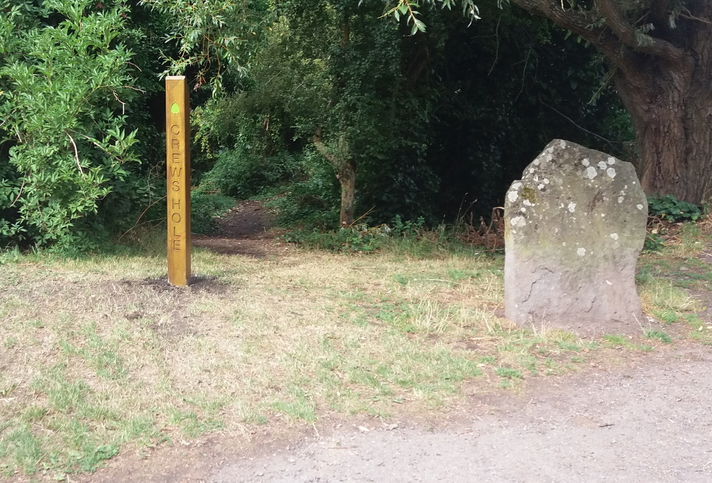 The waymarking highlights the routes from the top of the Hill and
 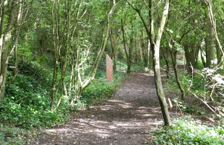 As part of our